Paintearth Economic Parthership Society
  • Home
  • More About PEPS
  • Business Opportunities
  • Regional Features
    • Castor
    • Coronation
    • Halkirk
    • County of Paintearth
  • Whats New
    • Gift Card
    • Essential Services
    • Government Resources

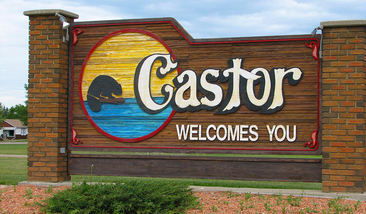
the town of castor welcomes you

Castor

Municipality website: www.castor.ca
Castor is located on Highway 12, just west of the Highway 36 junction.  Halfway between Red Deer and the Saskatchewan border, it's in the heart of East Central Alberta.  Trees throughout town and a creek in the center make it unique for the area, and very pretty.

The Town of Castor was incorporated on
July 13, 1910 with the completion of the Canadian Pacific Railway Line.
Picture


Indoor Recreation & Facilities
  • Castor Community Hall: kitchen facilities; seating capacity: 400 
  • Castor Legion Hall: kitchen facilities, shuffleboard, seating capacity: 100
  • Castor Curling Club: 3 ice sheets; upstairs lounge accommodates 125
  • Castor 'Beaver Dome' Arena: hockey & public skating (winter)
  • ​Golden Circle Club: kitchen facilities, floor curling, billiards, arts & crafts

Outdoor Recreation & Facilities
  • Castor Creek & Parr Reservoir: boating, day use / picnic area
  • Lions Campground: camping, picnic shelters, toilets, firewood; open year round
  • Castor Kinsmen Sports Ground: camping, ball diamonds; batting cage; rec shelter
  • Castor Centennial Swimming Pool: outdoor; 25 meter length; 5 lanes 
  • Castor Golf Club: 9 hole par 36 with grass greens
  • Castor Rodeo Grounds: home of annual Castor Rodeo (July); picnic tables; bleachers 
  • Castor Eastside Trout Pond: stocked with rainbow trout

Performing Arts 
  • Castor Little Theatre: local theatre troupe performs annually in Feb & March

Museums & Archives, and Points of Interest
  • Castor & District Museum: museum, machine shop & compound, grain elevator, school house and railcars 
  • Our Lady of the Rosary Historic Hospital: built in 1911; guided tours available
  • Murals: located throughout town

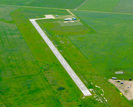
​Castor Airport (TC LID: CER2) 
 - Location: 1 Nautical Mile (1.9 km; 1.2 mi) west of Castor
 - Elevation: 2704 ft / 824 m
 - Coordinates: 52-13-00 N & 111-56-00 W
 - Runway Length = 3000 ft / 914 m (asphalt surface); Direction = 12/31
Picture
Visit our interactive Amenities Map where you can locate and identify many of the primary amenities county-wide, such as:
  • Municipal Services like Hospitals, Police & Schools,
  • Sports & Recreation facilities,
  • Industrial & Business Parks,
  • Campgrounds,
  • Museums & Points of Interest. 

View Regional Features for:  
​
Castor       |       Coronation       |       Halkirk       |       County of Paintearth

Copyright © ​2009-2015 Paintearth Economic Partnership Society.  All Rights Reserved.        Website by Next Phase Multimedia
  • Home
  • More About PEPS
  • Business Opportunities
  • Regional Features
    • Castor
    • Coronation
    • Halkirk
    • County of Paintearth
  • Whats New
    • Gift Card
    • Essential Services
    • Government Resources